Journal Boards
Editör

Engineering, Geomatic Engineering, Photogrametry, Geographical Information Systems (GIS) in Planning, Geological Sciences and Engineering, Remote Sensing
Editör Kurulu

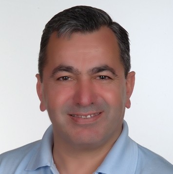
Dr. Dursun Zafer Seker has a Ph.D. in Geomatics from the Istanbul Technical University (ITU) Turkey. He was in UK, University of Newcastle upon Tyne for his postdoctoral studies. He is currently full Professor at the Istanbul Technical University, Department of Geomatics Engineering (since 2004), after being Associate Professor at the same department (1998 -2004). He was invited and worked as a guest professor in Gifu University, Japan for 1.5 years. He is giving lectures on Geographic Information Systems, Close Range Photogrammetry, Project Planning and Management at the undergraduate program. He also gives lecture of Coastal Data Management Systems at the Coastal Science and Engineering Systems graduate program. He gives several other courses at different graduate programs at ITU. He is the coordinator of the Geographical Information Technologies (GIT) Master of Science and PhD program. He acts as the head of the technical commission of the Photogrammetry and Remote Sensing of Chamber of Surveying since 2006. His expertise is on GIS, Photogrammetry, Remote Sensing, Coastal Zone Management, Integrated Watershed Management and Spatial data modelling and analysis from both the theoretical and empirical viewpoint. In these fields, he has been involved into several research projects both national and international, where these projects were inter-disciplinary. He is the author of over 70 SCI international papers and over 250 proceeding. He is also a frequent reviewer of different International Journals. He is also acting as an editorial board member in several national and international journals such as IJEGEO.
Image Processing, Artificial Intelligence, Photogrametry, Geographical Information Systems (GIS) in Planning, Remote Sensing
Prof. Dr. Reha Metin ALKAN
İSTANBUL TEKNİK ÜNİVERSİTESİ, İNŞAAT FAKÜLTESİ, GEOMATİK MÜHENDİSLİĞİ BÖLÜMÜ
 Türkiye
Web
 Türkiye
Web
Higher Education Studies, Geomatic Engineering, Satellite-Based Positioning, Surveying (Incl. Hydrographic Surveying)

Veli İlçi received the B.Sc. degree from the Department of Geomatics Engineering, Istanbul Technical University, the M.Sc. degree from the Department of Geomatics Engineering, Afyon Kocatepe University, and the Ph.D. degree from the Department of Geodetic Engineering, Yildiz Technical University. He was a Researcher with the Satellite Positioning and Inertial Navigation (SPIN) Laboratory, The Ohio State University. He is currently an Associate Professor with the Department of Geomatics Engineering, Ondokuz Mayis University, Samsun, Turkey. His research interests include automated vehicles, mobile mapping, 3D modelling, and indoor positioning.
Navigation and Position Fixing, Satellite-Based Positioning, Geomatic Engineering (Other)
Cartography and Digital Mapping

Photogrametry, Remote Sensing

Photogrametry, Photogrammetry and Remote Sensing, Geographical Information Systems (GIS) in Planning

Geomatic Engineering, Land Management, Cadastral and Property , Geographical Information Systems (GIS) in Planning
